


How to use Global Landslide Detector
This document provides a guide on how to use the Global Landslide Detector (GLD) system. As shown in Figure 1, the GLD homepage is mainly divided into two sections: (i) filters and (ii) results. Users apply filters through the various options available in the filters section and accordingly the system displays results in the form of tweets reporting landslides.
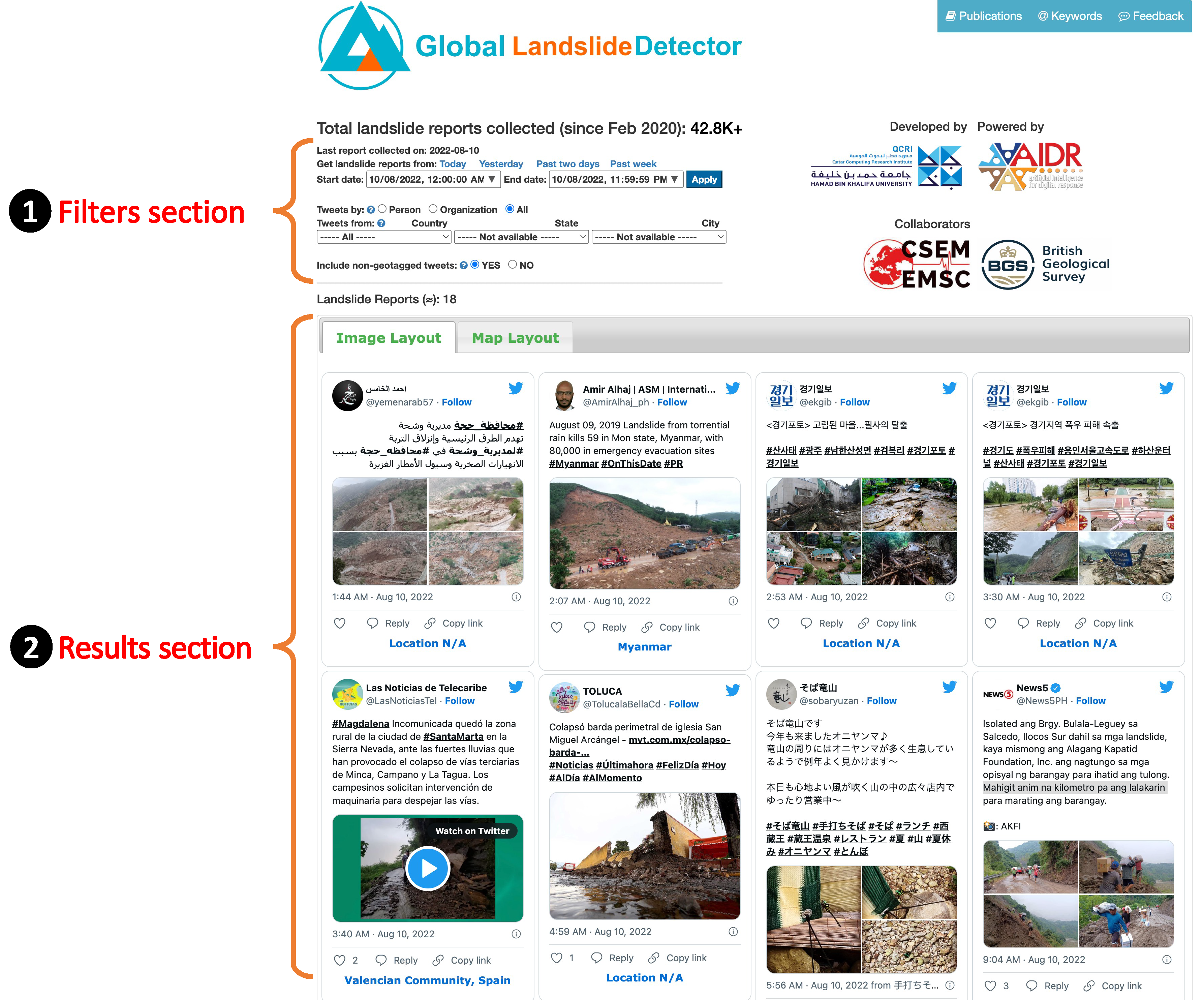
Figure 1
1. Filters
Figure 2 shows different filters available on the GLD page. These are mainly three types of filters as described below.
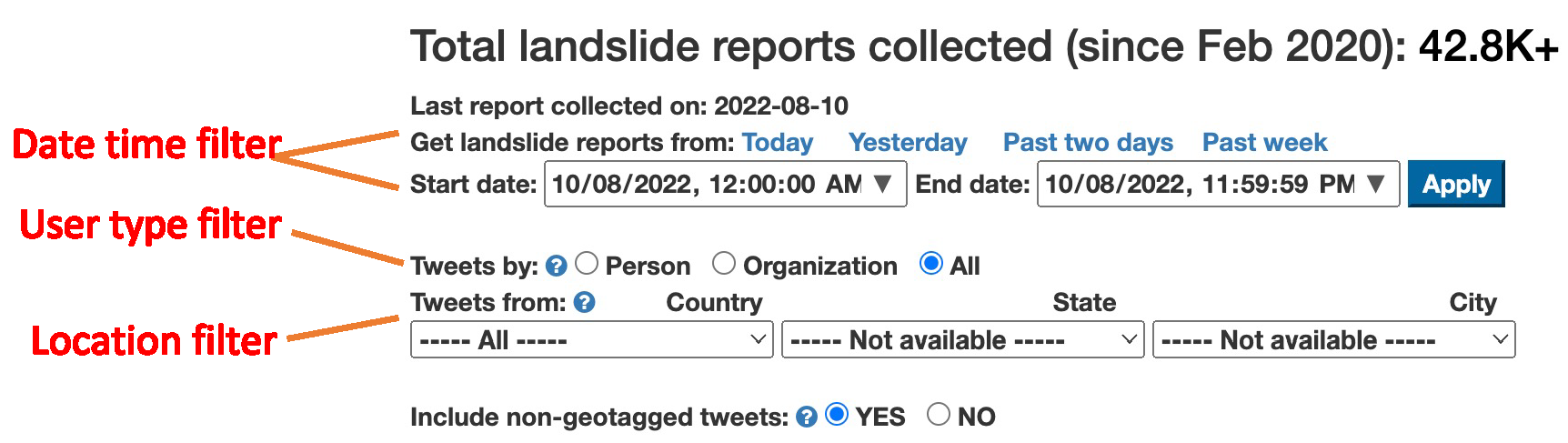
Figure 2
- Date time filter: A user can select one of the two options to get landslide reports from a given time period. Through the first option, the user can choose to see landslide reports from ‘Today’, ‘Yesterday’, ‘Past two days’, or from ‘Past week’. However, the user can also set a custom period by specifying a start date-time and an end date-time using the date-time dropdowns. The custom date time filter requires the user to click the “Apply” button to get results.
- User type filter: This filter enables users to select landslide reports posted by different types of users. The system can differentiate tweets posted by people or organizations (e.g., BBC, CNN). The user can choose to see posts from ‘Person’ or ‘Organization’ by selecting one of these two options or he/she can choose ‘all’ to get tweets from all types of users.
- Location filter: This filter provides options to choose a geographical area to get landslide reports detected within that area. The GLD system uses location clues in tweets text to geomap landslide reports. There are three options to choose from i.e., (i) country, (ii) state, and (iii) city.
2. Results
The results section displays landslide reports based on the filters selection by the user (Figure 3). Each report is shown in the Twitter recommended format including various other metadata fields such as user name, user’s screen name, tweet text, images showing landslide scenes, date time, etc. Underneath each landslide report, the inferred location of the landslide is displayed if available, otherwise “Location N/A” is displayed.
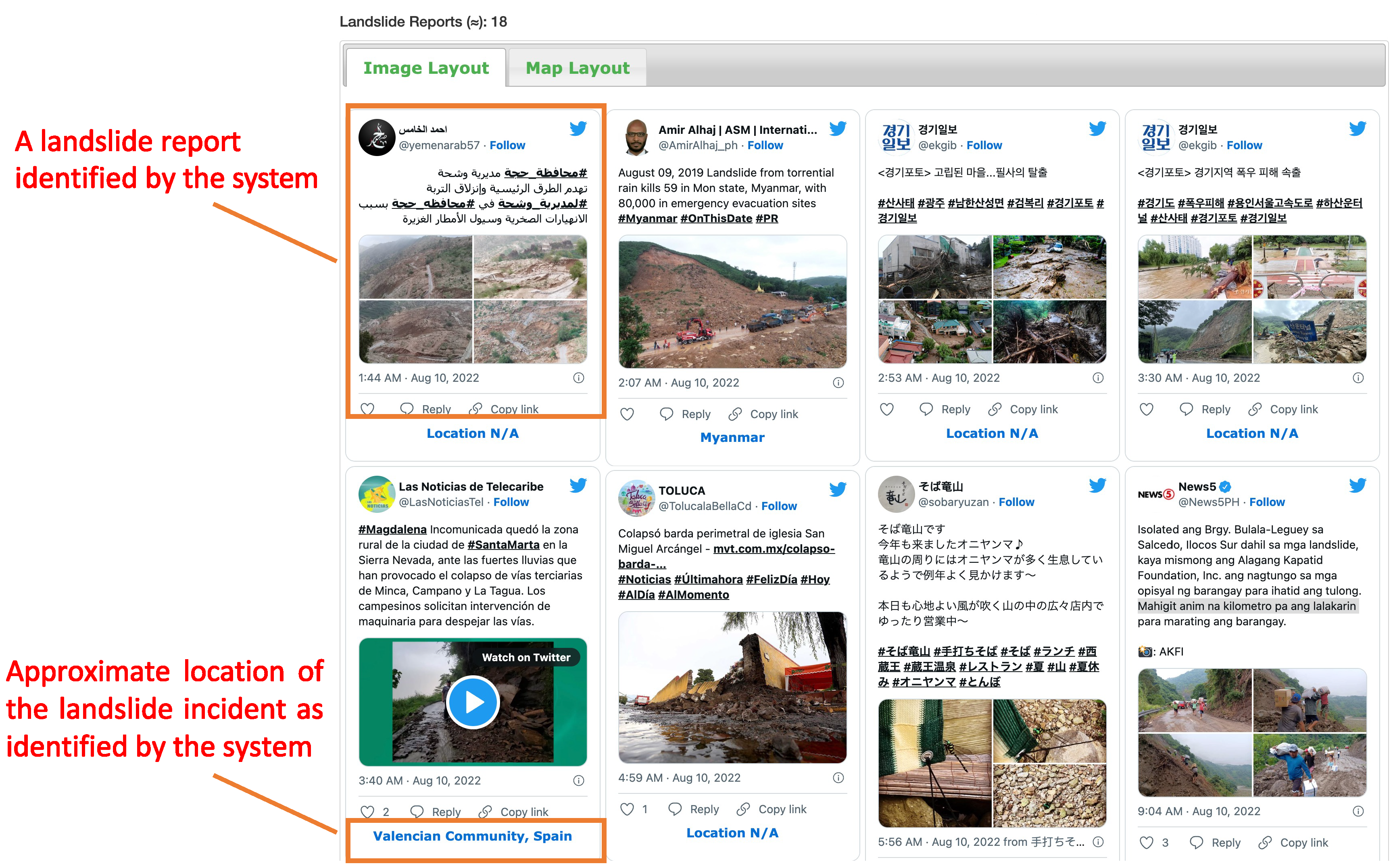
Figure 3
Limitations
Before using this tool, it is important to understand some of the limitations:
- This system does not replace expert survey. Data come from any social media user.
- Each photograph is analysed in isolation.
- The model does not discriminate landslide type but aims to recognise zones of depletion (where the material has come from) and accretion (where it has been deposited). This excludes scenarios where the landslide debris has been removed by coastal or fluvial erosion or where a landslide has been remediated.
- The model aims to show contemporary landslides
- There must be a clear representation of a landslide as the major component of the image
- Where representation was borderline, consideration was given to whether the end user would be concerned by the image being returned as a landslide, e.g., in the situation where another geomorphological feature such as a retaining wall or a sinkhole might be returned as a landslide.
- The methodology aimed to identify landslide features, but the task was not to discriminate scale, meaning that images labelled as landslides may be very small (<1m and not strictly a landslide) and aerial photographs including multiple landslide events are not captured by the model.
- The model is not intended to be used in isolation during a disaster scenario but could complement existing workflows providing new data coupled with an understanding of the above limitations and data biases (e.g. mobile coverage, widespread use of social media, population density).
- Locational accuracy of landslide tweets is automated and still a work in progress.